


Boucher Hill - Peak #63 - Will this peak be closed with Palomar Mountain State Park?
Boucher Hill
Elevation: 4,438′
Total Mileage: 3.5
Trailhead: Silvercrest Picnic Area
Agency: Palomar Mountain State Park
Dates Hiked: 10/21/2006, 06/02/2011, 05/19/2018, 06/14/2018, 10/15/2018, 10/21/2020
Peakbagger.com Page
For those interested, here is a list of my gear that I have found works well for me. This is, of course, an affiliate link and your enjoyment of these may vary:
06/02/2011
After reading a recent article about the renovation of the Boucher Hill Fire Lookout Tower and knowing that Palomar Mountain State Park is slated to be closed as a result of budget cuts from Sacramento, I decided to make Boucher Hill a priority. I summited the peak back in 2006 with my brothers-in-law and had a great time, but it wasn't officially part of the 100 Peaks quest at that time, so I wanted to summit it again.
Knowing I could squeeze it in the middle of a work day (I have a flexible schedule), I made the beautiful drive through Pala and Pauma Valley. I couldn't smell the citrus blossoms like I sometime can in the spring, but it was a really nice morning. The temperature rose from 75 to 85 as I made my way around winding roads and past cyclists and motorcycle groups to higher elevations on the mountain. It was going to be a warm day.
Upon exiting my car, I was immediately attacked by flies that swarmed to my face and skin and came from everywhere. Within a minute, the extended family of flies showed up and blinded me until I was able to put on some DEET.
Luckily, I have a bag in my car that contains a lot of things like sunscreen and insect repellent. You never know what you're going to need once you get to a trailhead. Although the DEET didn't keep the flies completely away, I am sure it mitigated the annoyance quite a bit.
Eager to get going, I walked around the Silvercrest Picnic Area, looking for the trail. The best way might be to walk up Nate Harrison Grade until you get the to actual trailhead, but I followed a use trail past a ranger cabin. Although Boucher Hill is technically a drive-up peak, it is nicer and more fulfilling to hike your way up.

Boucher Hill Trailhead
Down to the valley on the Boucher Hill Trail
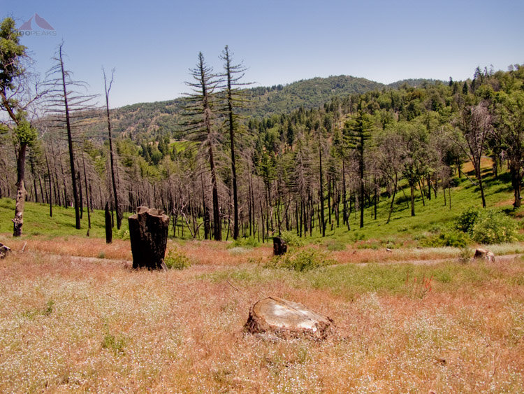
The trail immediately gains some altitude as I followed the ridgeline between the two one-way paved access roads, but it gave me some shade. I was truly in a beautiful forest setting, surrounded by pines and oaks.
The flies would subside a little bit while I was hiking, but the second I would stop for a picture or a video, they would all start landing again. As I ascended the ridge line, I got a nice view into the valley below to the east.
Before long, I was at the top of Boucher Hill. There is a great deal of construction going on, but the view is great.
Palomar Mountain drops off pretty sharply to the west so I got a feeling that I was hovering over the valley below. I wanted to sit and relax on the benches on the wonderful viewing platform, but the flies wouldn't let me, so I quickly continued on.

View north to Santiago Peak from Boucher Hill

View to Pauma Valley from Boucher Hill

Boucher Hill Fire Lookout Tower Under Construction
Instead of making this hike the shortest it could have been by retracing my steps to the picnic area, I decided to make a nice loop around the park, which turned out to be a great idea.
The trail leads off to the north of the viewing platform and immediately it feels more lush, as this is on the northern side of the mountain. The spring rains have given the brush some fuel to grow, so I had to squeeze through a great deal of green plants in bloom while not being able to see my feet at times.
After making my way out the other side and startling some quail, I did a quick tick check and hiked on.

View into Pauma Valley from the Boucher Hill Trail

The trail is a little overgrown in parts
Now that I could see the ground, I noticed some large turkey tracks, so I kept my eye out for them. Sure enough, a few hundred yards later, I saw a family of turkeys crossing a ravine down below the trail. They were gone before I could get my camera out.
This was such a pleasant trail for hiking. It reminded me of some of the gentler areas of the Sierras. I crossed a creek and climbed up a green meadow and made my way to Scott's Cabin Trail, on which there is no remaining cabin. The trail began to climb again as it headed back towards my point of origin.

Shady Trail through the Oaks and Pines

Azalea Creek and meadow near Cedar Grove Group Campground

Shady Scott's Cabin Trail
It was a really nice hike, but I was glad to be back in the car and safe from the flies. The thermometer in the car read 94F. It had heated up quite a bit.
Visit the park while you can, it is scheduled to have limited hours starting September 2011, and is expected to close completely in July 2012.
Update: The park has been able to remain open over the years. I was able to hike to this peak in 2018 from the valley floor, making it a pleasant 20 miles. I had lunch on the deck of the lookout tower after getting a tour from the volunteers.
Boucher Hill Trail Map (Click to Enlarge)

Palomar Mountain State Park Closure Notice